 Hiking in Lovozero mountains
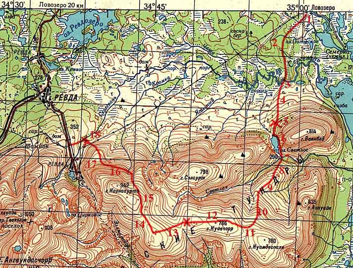
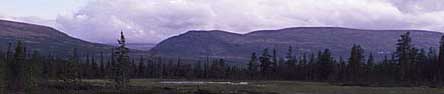
Hiking in Lovozero mountainsThis is a short description about a 3-day hike accross the Northern part of Lovozero mountains. X in the map is my camping site which propably doesn't really mean anything you may think about a campsite. This route is not a path, trail, suggestion or whatsoever, it is my route which I took alone and walked in about three days. Remember that this information may be old by now, but I'm sure it's better than nothing if you consider hiking there.
I made my hike in August 1997. Then there were some buses per day from Olenogorsk railway station to Lovozero and Revda. As far as I understood, there were a bus from Murmansk to Lovozero three times a week. I took a 'private' taxi from Olenogorsk city to Lovozero since it seemed to be the only way to get there quickly. I returned to Olenogorsk station by bus from Revda. There are lots of trains that stop in Olenogorsk, so don't worry about getting there. It seems to be easier to get to Revda than to Lovozero. Lovozero might be more interesting, although I didn't spend time there at all for practical reasons.
1. Start, try to find the beginning of the trail otherwise you may end up to the wetlands.
2. Easy-to-walk forest, 2-3 km/h
3. No bridge, must swim, easy to swim, 10-15 meters wide, slow flow. Partly visible trail leads to the river, probably from the village
4. Clearcut pine forest, disaster area, very easy to go, 4-5 km/h
5. Difficult slope, bushes and rocks.
6. Clear trail along the shore, 2-3 km/h, lots of stones.
7. No bridge, ford but strong flow, occasional tree trunks over the river, impossible to swim. Birch-bus along the riverside, difficult to go, 1 km/h.
8. Stones and rocks on this slope, < 1 km/h horizontally, not very difficult but no trails here although marked in some maps. Propably often used route anyway.
9. 4-5 km/h, flat, very easy plateau.
10. 2 km/h rising, occasionally lots of stones, then < 1 km/h.
11. More or less flat plateau, lichen covered stones or only stones. Still < 2 km/h, must watch the step.
12. Like 11 but smaller stones and flat, easy 2 km/h.
13. Like 11.
14. "road", barak, partly destroyed, one wall burned away.
15. Airplane wreck, probably from 1970's or older.
16. Steep, very stony slopes, << 1 km/h, road goes down to Revda mines.
17. piles of waste-stones, roads and ventilation holes to the mines.
18. Sludge lakes, dams, pipelines, open mine, pumping station etc. Buses run from the city to the mine "Karnasurta". Watch the dog in the wastewater pumping station. Not a pleasant meeting, very angy!!